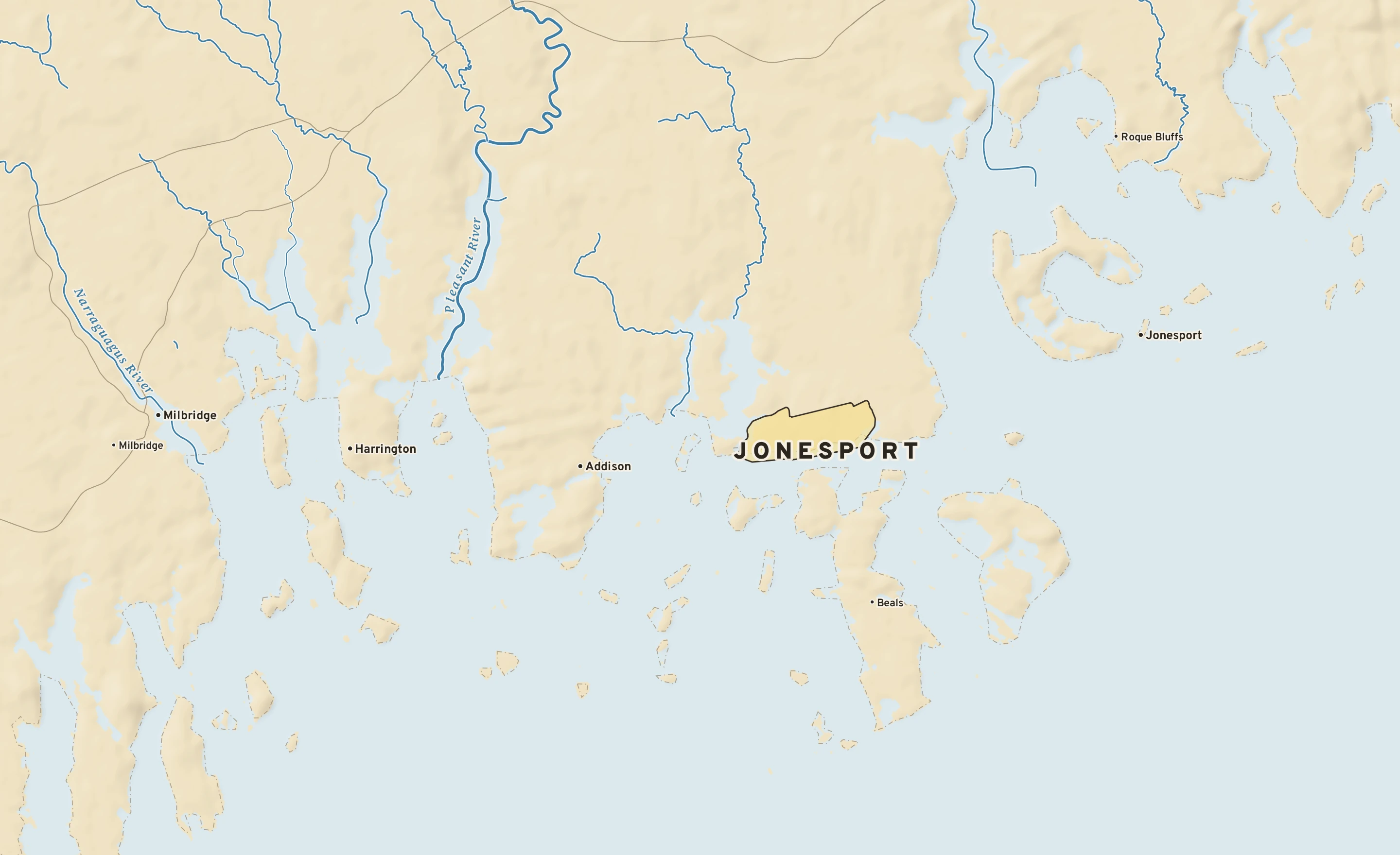
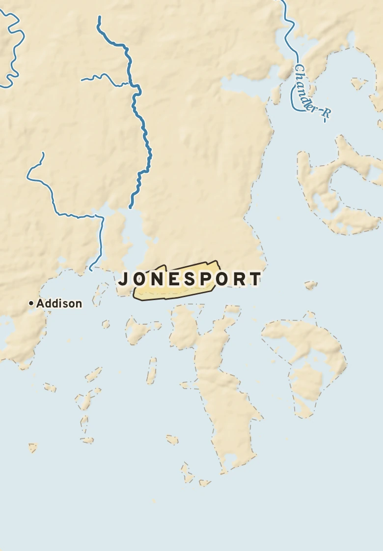
The Jonesport plate. Relief from Copernicus GLO-30; rivers and lakes from USGS NHD; watersheds from the USGS Watershed Boundary Dataset; roads and city limits from Census TIGER 2024.
MILE1
TODAY
Today in Jonesport
NWS forecast and National Blend of Models · updated 4:00 PM EST
RIGHT NOWCutler Farris Wharf (CWSS) · 4:00 PM
37°SunnyFeels like 37° · high of 38° near 4 PM
WindWNW 1 mphno gusts
Humidity81%rising to 100% by morning
Pressure— in →steady
Visibility— mifog or heavy haze
CloudsClear
UV index—no forecast
Dew point 32° · Dryabout the same for three days
DryComfortableStickyMuggyOppressive
NEXT RAIN
Not this weeknone in the forecast for a week
LIKELY AMOUNT—nothing expected
LAST RAINNov. 120.01 in · 2 dry days
ALERTS & OUTLOOKS
No watches or warnings for Washington County
NWS Caribou and the Storm Prediction Center · checked 4:46 PM
SUN & MOON
↑ 6:25 AM4:04 PM ↓
9 h 39 m of daylight, 2 minutes less than yesterday
Waxing crescent, 26% lit. Next full moon: Nov. 24.
AIR & POLLEN
21
GOODAir quality index · fine particles
Tomorrow: None, good. No pollen source yet.
The next three days, hour by hour
Sky: clear, cloudy, nightRain likelyNational Blend of Models
Forecast, with the range 8 in 10 ensemble members agree onNormal, about 80° / 62°
SATNov. 14Mostly cloudy
38°29°
0% rain—NNW 2A
SUNNov. 15Mostly cloudy
43°29°
10% rain—NW 8A
MONNov. 16Partly cloudy
44°29°
0% rain—NW 6A
TUENov. 17Partly cloudy
49°37°
0% rain—WSW 6A
WEDNov. 18Partly cloudy
52°40°
0% rain—W 3A
THUNov. 19Mostly sunny
53°41°
0% rain—SW 2A
FRINov. 20Partly cloudy
53°36°
0% rain—WNW 3B
How sure are we?AModels agree: highs within 4°BSome spread: within 8°CWide spread: check backRange from the National Blend of Models percentiles · graded on Forecast Scores
AIR MAIL
Where today’s air came from
The air arriving over Jonesport about 5,000 feet above the ground was over Canada three days ago, and over Ontario a day ago, about 2,680 miles back along its path. It came down from about 10,500 feet up, warming and drying as it sank. Near the ground the air came from the Canadian Prairies; at 10,000 feet, from Canada. It has stayed over land, which is why it feels dry. Traced back 72 hours through NOAA’s hourly RAP analyses and the GFS beyond them, nine paths at each of three heights.
MILE2
THE GROUND
What Jonesport stands on
Jonesport’s center stands about 80 ft above sea level. Within three miles the land runs from 0 ft to 100 ft, a difference of 100 ft: gently rolling country. Open water lies within three miles. The highest named summit within 15 miles is Patten Hill, about 480 ft, 15 miles north-northwest.
Under the town center the state geologic map shows Devonian gabbro/diorite/ultramafic rocks - quartz diorite, from the Devonian, 359 to 422 million years old.
The section below crosses 7 rock units mapped at the surface.
Jonesport, cut in half from south to north
A section south to north, 24 miles through the town center
Heights every 0.1 mile from the Copernicus GLO-90 surface model; vertical exaggeration about 64×. The colored band under the surface is the rock the state geologic map shows at the surface, not a picture of what lies beneath.
Age: Devonian, 359 to 422 million years old. About 5 mi of the line.
Silurian Quoddy Formation, undifferentiated volcanic rock member
Volcanic. Age: Silurian, 422 to 445 million years old. About 3 mi of the line.
Devonian granite
Granite. Age: Devonian, 359 to 422 million years old. About 2 mi of the line.
Silurian Dennys Formation, mafic to felsic volcanic rock member
Mafic-volcanic, felsic-volcanic. Age: Silurian, 422 to 445 million years old. About 2 mi of the line.
Silurian Quoddy Formation, mafic to felsic volcanic rock member
Felsic-volcanic, mafic-volcanic. Age: Silurian, 422 to 445 million years old. About 2 mi of the line.
Ordovician - Precambrian Z Columbia Falls Formation
Mafic-volcanic, felsic-volcanic. Age: Neoproterozoic to Ordovician, 445 to 1,000 million years old. About 1 mi of the line.
From the USGS State Geologic Map Compilation (Horton and others, 2017), the states’ geologic maps joined at a common scale. 1 smaller unit along the line are not listed.
Heights from Copernicus GLO-90 (a surface model: it includes buildings and tree canopy); summits from USGS GNIS; rivers from USGS NHDPlus HR; rock from the USGS State Geologic Map Compilation.
MILE3
THE WATER
Where Jonesport’s rain goes
Rain that falls on Jonesport runs straight into the Atlantic Ocean.
FROM THE CENTER OF JONESPORT< 2 mito the Atlantic Oceanstraight to the shore
Traced down the USGS NHDPlus V2.1 river network from the Census center point of Jonesport; river miles along the main stem, rounded.
Letters show how sure the forecast is: A, models agree; B, some spread; C, check back. Sample data.
2
What Jonesport stands on
Jonesport’s center stands about 80 ft above sea level. Within three miles the land runs from 0 ft to 100 ft, a difference of 100 ft: gently rolling country. Open water lies within three miles. The highest named summit within 15 miles is Patten Hill, about 480 ft, 15 miles north-northwest.
Jonesport, south to north24 miles through the town center; vertical exaggeration about 122×. Colors: rock at the surface.
Elevation, center80 ft
Within 3 miles0 to 100 ft
Lie of the landGently rolling (100 ft of relief)
High point nearbyPatten Hill, 480 ft, 15 mi north-northwest
Rock at the surfaceDevonian gabbro/diorite/ultramafic rocks - quartz diorite
Its ageDevonian, 359 to 422 million years old
3
Where the rain goes
< 2 mito the Atlantic Oceanstraight to the shore
Rain that falls on Jonesport runs straight into the Atlantic Ocean.